
Skiing Doko’o’osliid: A suprising palace of snow above the Grand Canyon:
Floating downward on excellent April powder I felt the solitude of an amazing wilderness that flowed from the Grand Canyon to the north side of the San Francisco Peaks.
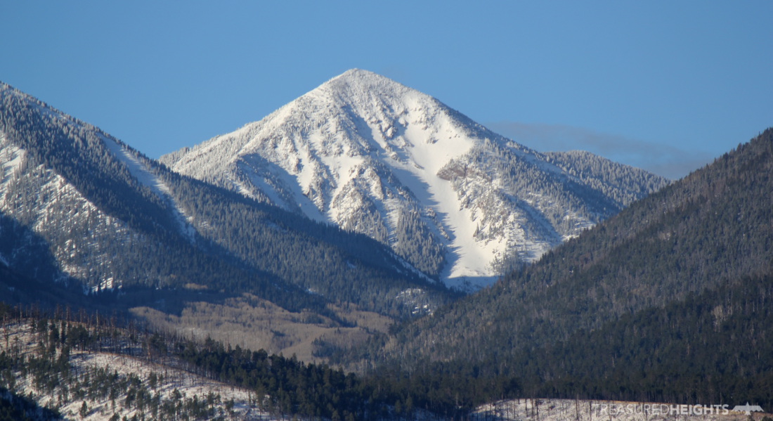
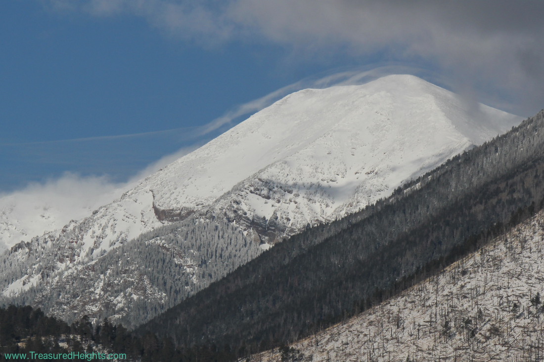
Arizona had the best snow conditions I’d encountered anywhere in the Skiing States project. It was a good normal snow year in 2016 for Humphrey’s Peak (Doko’o’osliid in Navajo). I’d been eying Humphreys since 2008 when I first flew over it on a flight to Vegas.
Island of snow in the sky:
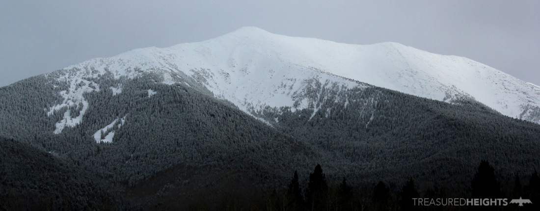
Doko’o’osliid is part of the San Francisco Peaks, aka The Kachina Peaks. This cluster of peaks over 11,000’ contain a lot of ski lines and a beautiful wilderness area which comparatively few people visit in the winter. The peaks are completely surrounded by desert on all sides and are not connected to any ranges. The approaches can be long as key access roads are gated in the winter, but there be heavenly powder up there! The peaks sit within Coconino National Forest just to the north of Flagstaff. To the east of the peaks is Sunset Crater and cluster of volcanos that last erupted only 1000 years ago and could reawaken at any time.
One of the four sacred peaks:
Doko’o’osliid is one of proper names for Humphrey’s Peak and it is one of the four primary sacred peaks in Navajo culture. The peak is also important for the Hopi. For the Navajo four sacred peaks are spaced out around the Navajo territory with Sisnaajini (Blanca Peak, CO), Tsoodzil (Mt. Talyor, NM) and Dibe Ntsaa (Hesperus Mtn, CO). These peaks are a part of the Navajo creation story. When you are on this lone volcano surrounded by vast landscapes you can understand how this peak is special.
To Arizona and California:
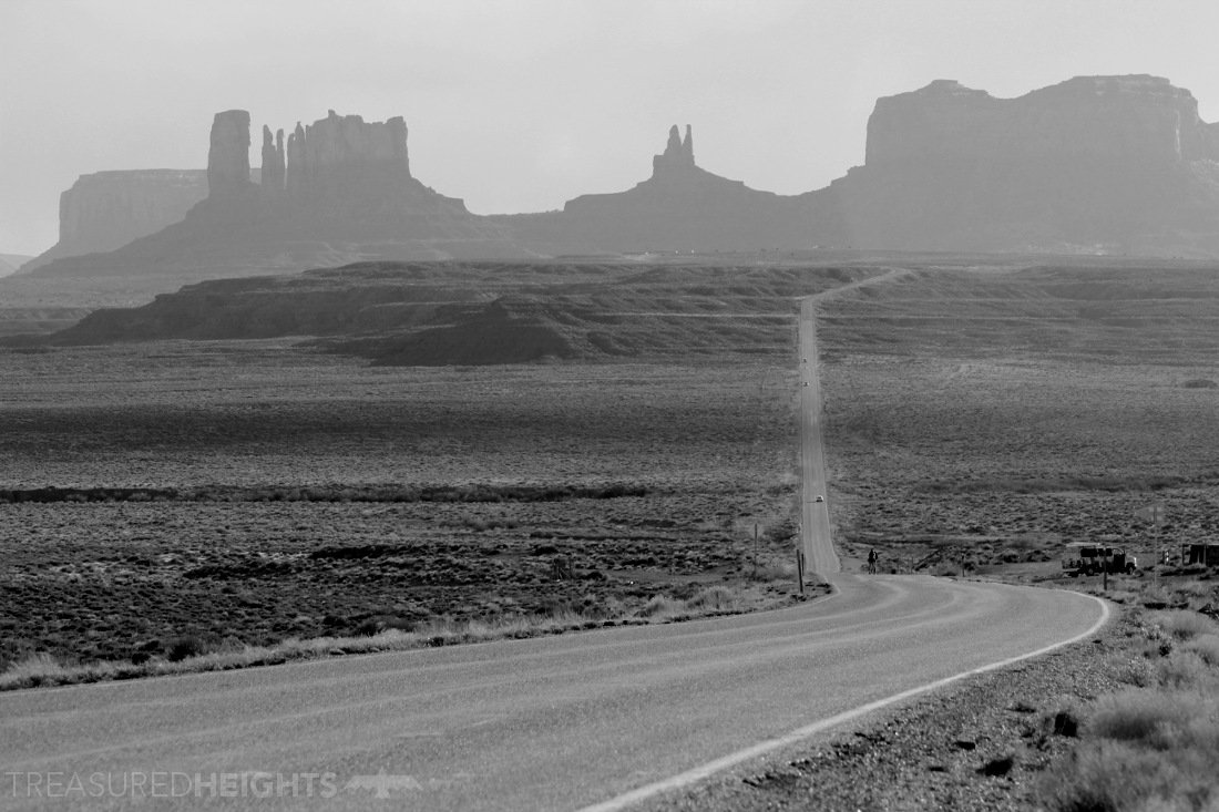
In many movies you see road trips through the desert towers of Monument Valley, this of course is contrived because it’s not really on any major East-West routes. My trip actually did go through Monument Valley’s red sandstone towers as a natural driving route.
Very little beta, discovering the line:
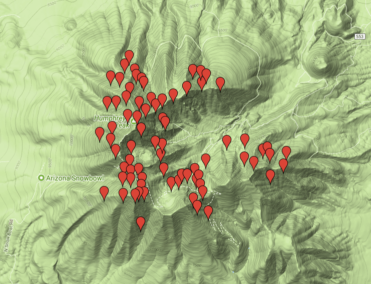
Most people ski the peak from the Arizona Snow Bowl as it’s the shortest approach, however it’s a contrived line and I was looking for a more natural ski line. Normally I ski the state high points from the traditional first descent lines, but in this case the first descent from summit is unknown so I was not tied to any line.
I spent more than a full day circling the mountains 360 degrees by car to get beta on the peak. I know the southwestern peaks get large bare sections so you want to pick the line with the best coverage. There was no good info on any website about ski lines for the peak in 2016, and locals probably liked it that way. Flagstaff is no Boulder or Jackson. While it may be a college town with people who love the outdoors, Arizona is no magnet for backcountry skiers and splitboarders. There is a very small community of backcountry skiers there and some have published rough videos on lines close to the Snowbowl, or trip reports with photos. There is enough skiers there to have a Kachina Peaks Avalanche Center website though (link at the end of article). There was not enough material for me to feel satisfied and I wanted to get to know the peak better, so there was an exciting feeling of discovery.
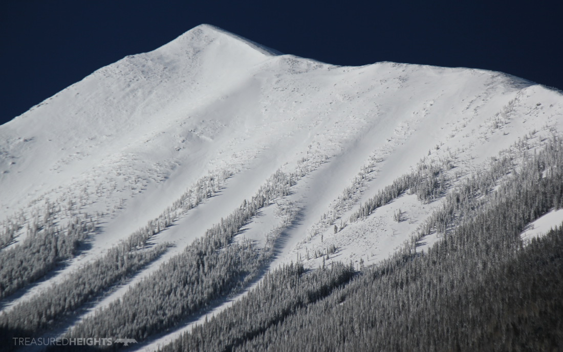
Abineau Canyon:
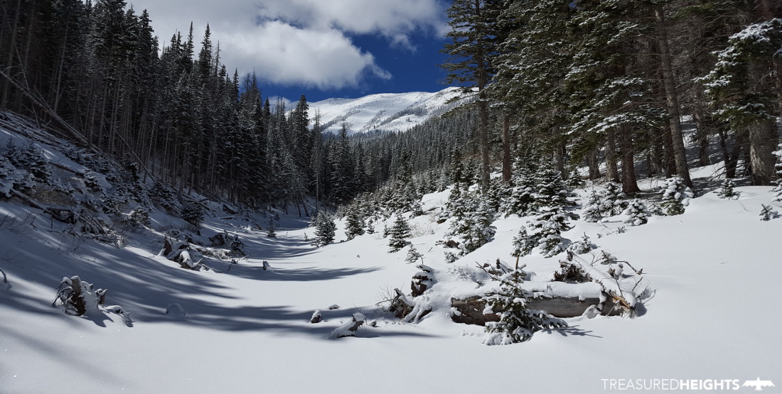
Late March snowstorms had whacked the mountain and I skinned up through fresh snow until I finally reached the impressive finger of destruction caused by a single massive avalanche in 2005. I loved how this had opened up the streambed and made for more efficient skinning and views of the bowl ahead. I didn’t have firm plan as to which route to go up and the great visibility below the slide paths allowed me to pick a way up using strips of forest between gullies.
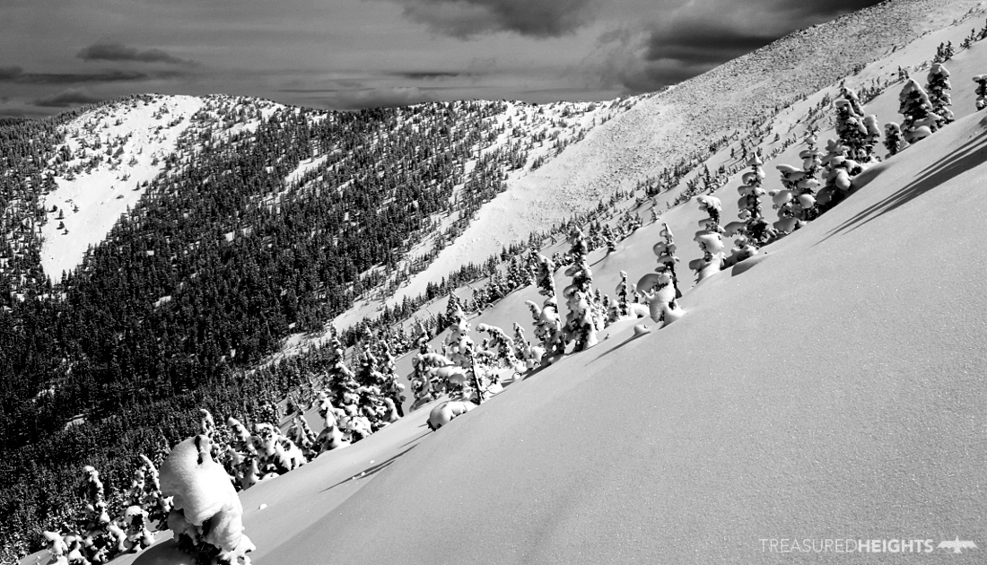
 The route choice would prove great for skiing, but not good for reaching the summit. I was clearly hitting the best snow of the peak here in this NE face, but the top section was a horrible steep boot pack through soft snow.
The ski down was amazing for many reasons. Being on the north side of the peak you are alone in a great western wilderness. It was a lot of driving on rough dirt roads just to reach the trailhead alone, so there is a feeling of remoteness being way up in there. Also you get a view north to the Grand Canyon over the Kaibab National Forest.
Every single trip report I’d seen always talked about skiing the peak via the rocky ridge leading up from the south at the AZ Snow Bowl. This approach from the north is different. It is aesthetic and natural without dealing with the loud music from the tourists who park at the ski area just to get a look at snow, or seeing man-made ski trails, towers and cables along the ascent.
The experience of skiing the gullies late season when the snow was safe, under dry SW powder in a great wilderness was incredible. There are of course many other great lines to ski in these peaks, so it would be nice to return some day. If you love these kind of peaks which are islands of snow surrounded by desert I’m sure you will have a great time there too.
MOUNTAIN FACTS:
Names: Humphreys Peak. Nuva’tuk-iya-ovi (Place of High Snows) – Hopi, Dook’o’oslid (Shining on Top) or Diichili Dzil (Abalone Shell Mountain) – Navajo
Land: Coconino National Forest
Elevation: 12635’ (3852m)
Vertical: 4235’ from the north, 3250’ from the Snow Bowl side
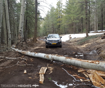
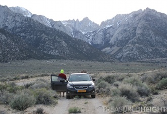
Access: Park at the ski area, or for other approaches use forest roads which encircle the peak, 8”+ clearance required. Be aware that landowners appear to be illegally locking gates on the West side (US Rt. 180) so you may have to drive in from the east side of the peaks, which adds considerable mileage. Gates were open when I was there, but I’m not sure if those gates are closed in mid winter.
Red tape: Camping permits are required even in winter, see the link in the Links section below.
Conservation issues:
There is plenty of anti-public lands sentiment in Arizona which is a major threat to all natural areas left in the state. US Congressman Paul Gosar from Western AZ has introduced bills which would allow for oil drilling and mining inside National Parks – few congressman have been this boldly anti-public lands. Most AZ state politicians are nothing but Koch puppets who represent the extraction and ranching industry. Another minority block of control (democrat) sits with tribal-elected representatives. Arizona along with Utah and Idaho are strongholds for Super PACs which are focused on destruction of the last blocks of wilderness in the West for both corporate profits. A tradition of crass extractionism goes back 100+ years and is the reason why even gems such as the Grand Canyon were almost destroyed by mining and other interests.
The fact is that Arizona “public” and tribal lands have been under attack since Brigadier General Andrew Atkinson Humphreys interpreted survey data from the Arizona region in the 1800’s. So naming the peak “Humphrey’s Peak” is a small act of imperialism to erase the culture of the Hopi and Navajo. The name should be changed as we did in South Dakota, where “Harney Peak”, was changed to Black Elk Peak.
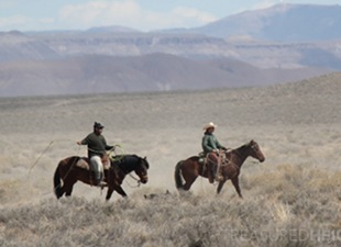
Len Necefer, a Dine (Navajo) skier talks about Arizona, backcountry skiing and land issues related in the first video of several by Treasured Heights. Some of my footage of skiing Arizona’s highest peak is used in the broll while he speaks:
AVY RESOURCES:
Don’t expect extensive coverage of Arizona’s snowy ranges like you can see in the Sierras or Colorado, however thankfully there is the Kachina Peaks Avalanche Center >
VIDEOS:
Several videos are in production on this peak. The first is embedded above. To check if newer videos have been uploaded just check the Treasured Heights YouTube Channel.
LINKS:
Backcountry permits:
https://www.fs.usda.gov/main/coconino/passes-permits
Arizona Snow Bowl: a ski area on the south part of the massif
Sunset Craters:
https://www.azcentral.com/story/news/local/phoenix-contributor/2016/04/05/could-volcanoes-reawaken-arizona/82635324/
 Get weekly photos on your feed from Treasured Heights from around the US on Facebook or , Instagram