
I’d waited two years to ski Whitney due to poor snow conditions, 2016 was not a great year, but seemed good enough to take on the peak. The Sierra Nevada are often referred to as the mountains of light or similar such names. This is due to the abundance of sunshine, the light-colored granite and snow.
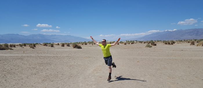
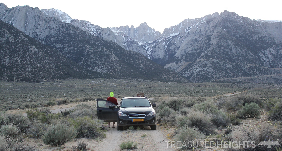
 The good part about lack of snow was that access would be higher, at the summer trailhead. Will and I had a long drive from Las Vegas, crossing the vast expanses of Nevada desert and Death Valley. Going from below sea level to the highest mountain in the lower 48 is fun journey. We crossed military test areas where we were buzzed by a fighter jet at intercept course, 100′ off the ground.
After 23 years, finally skiing on Whitney:
I’d driven on some of the same roads 3 years ago when going to ski Boundary Peak – Nevada’s highest point. Once again I’d pass the glimmering snowy peak of Mount Charleston. I’ve been meaning to ski that since I first saw it in 1998, Whitney however was the priority and had a much older appeal. When I was in highschool I’d had a beautiful black and white photo of Whitney from the Black Diamond catalogue taped to the bedroom wall. I had mountains on the wall instead of pin-up girls that most guys had. I intimately studied the couloirs, imagined what it would be like to ski on them. It’s good to hug trees and lick rocks.
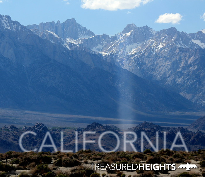
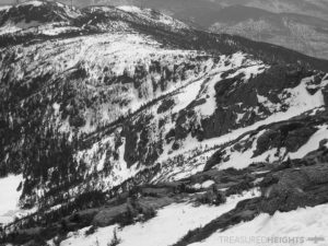
Dropping into the Owen’s Valley Mount Whitney becomes visible 10,000 vertical feet above. I was familiar with Rainier’s great 10k’ drop, but this was different. This was a wall of hazy peaks, a different type of beauty. Increasing the drama of the view was the massive dust devils which spun in front of the peak.
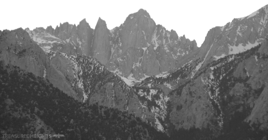
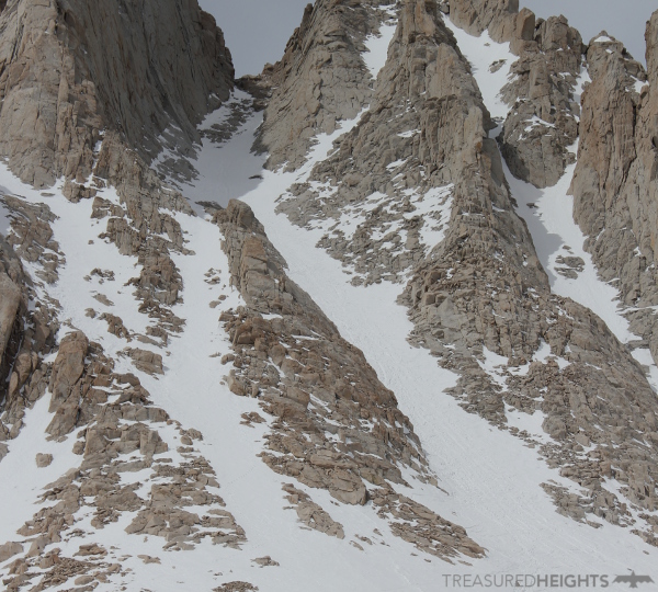
From this point I got a really good view of Whitney and the Mountaineers Route which I was going to ski. I have to say from this vantage point it was extremely intimidating. “Damn that looked steep!” I said to Will.
We pushed forward and got the permits from the ranger station. A ranger said two guys had skied there two weeks ago, when the conditions were better. Whitney is not skied often compared to other summits. This is due to a few factors such as there are many better routes to ski in the nearby Sierra! The Mountaineers Route often gets marked with post-holes from other users. The surface conditions are often icy or crusty in addition to the ugly boot holes. Many times the couloir has snow but the upper connector couloir to the summit is unskiably thin. In addition to this, after March there is a convoluted lottery system limiting and fixing when a person can do the peak because it’s so popular. The reason you ski at Whitney is for the aesthetics of the peak, the views, but rarely for the snow quality and good turns. As it turns out 2017 was a great year, but I opted to go to Mt. Baker instead.
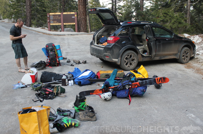
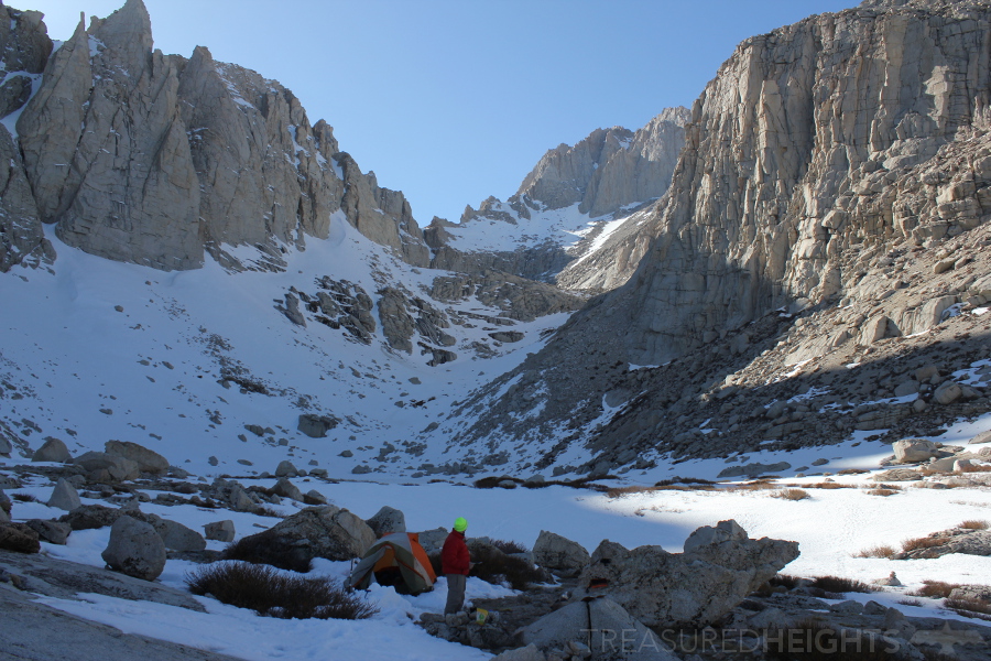
We luckily were able to drive up to the summer trailhead and rest. The next morning we huffed and puffed up the first drainage. To me this seemed to be the hardest part of the mountain. It was consistent and it was easy to posthole here. It was too steep to ski or snowshoe. Finally after a slog it flattened out and a beautiful view of Whitney finally appeared. If you do this mountain, please do the drainage in the early morning when its hard and sooo much easier.
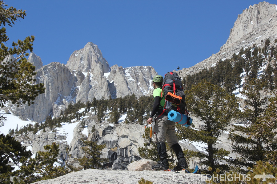
From here I gladly put on the skins and ski around a depression that had no outlet.  We continued up to our camping destination. My heavy pack really wasted a lot of my energy and I felt beat up. The air was warm and friendly and we gathered water from the Upper Boyscout Lake.
We were alone in the grandeur of the pink granite towers and sunset light. Normally when I winter camp in such a bowl I’m scouting other good lines to ski nearby, and sometimes do some side trips to kill the rest of the light of the day. In this case I didn’t see a single good line for skiing. The excitement for climbing however was activated. From our spot we could look down and see the barren valley and snow-starved White Mountains. The White Mountains are a high range, but are located in a really bad spot for moisture just east of the massive wall of the High Sierra.
At night the temperature never dropped as expected. The stars were amazing. I set the alarm for a good hour, but breakfast and preparations took far longer than it should. I was really concerned about icy conditions on the Mountaineers Route. The route stays in the shade for a long time. By delaying I’d have a better chance of hitting at the right time.
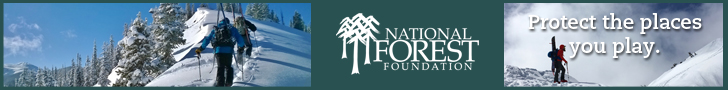
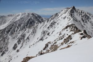
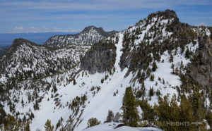
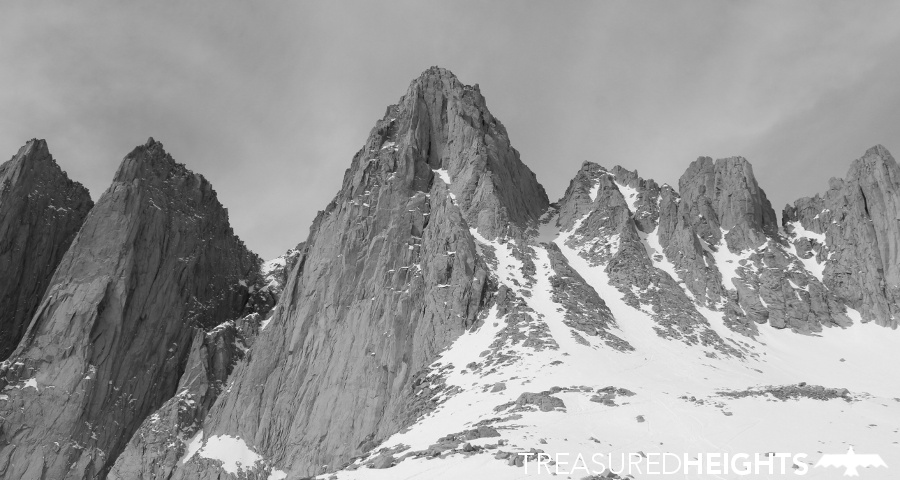 The problem with the plan is that I didn’t anticipate the power of the sun in the Sierra. We were just cooking on the way up to the upper basin. We relaxed below the summit. The peak is really amazing close up. There are three massive formations of granite that make the peak unique. I could sit and admire the peak for a long time if it was possible.
Skiing the Mountaineers Route:
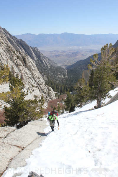
I skinned up the apron to the base of the Mountaineers Route. The place wasn’t totally wrecked by boot traffic but was still in bad shape. People didn’t stay in one track, they wandered, creating maximum destruction, this is also a waste of energy as the steps are already set. I booted up the couloir. Close to the top I had to make a judgement of whether to continue, or ski the couloir and come back again another time for the summit section. It was a very difficult decision being so close to the top, but I chose the safer option. I’d really like to do this thing right in the right conditions. Under these sparse conditions the segment from the top of the Mountaineers Route up the other couloir to the summit was not in, which is common. I skied down chunky stuff. It was better than ice because it had some softness, but overall it didn’t get fun until near the apron when I could let it rip on smooth surface.
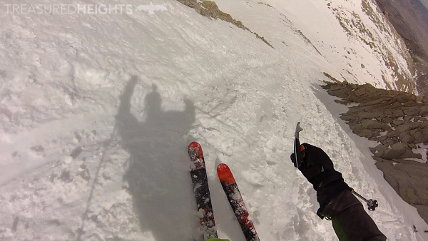
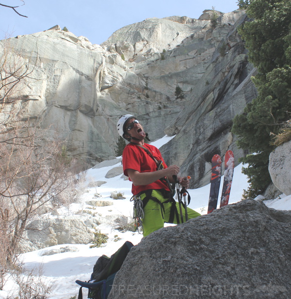
After skiing down the apron we skied another steep section which had some excellent corn. Back to camp, break camp. Then some crappy skiing on slush.
Overall there was more than 5000′ vert of relief done on this attempt, and like any peak with a lot of vert you’ll experience the full mix of ice, good corn, slush, then rotten slush.
Being with heavy overnight pack the skiing was quite bad. A lot of people opt for doing the peak in one push from the parking lot. This may be a better option, however it was delightful sleeping up high instead of on a picnic table in the Whitney Portal. We drove out having enjoyed the solitude of the month of March on what normally is a packed mountain.

MOUNTAIN FACTS:
Names: Mount Whitney, Tumanguya
Land: Inyo National Forest
Range: Sierra Nevada
Elevation: 14,494′ (4418 meters)
Vertical: 6134′ (starting from Whitney Portal, if its a snowy year and the road is blocked you may have to start from 6500, giving 7994′ of vertical)
Fauna of note: bear, use a bear cannister
Conservation threats: Overuse by tourists, so permits are issued.
Original owners: The Paiute named the peak Tumanguya.
AVY RESOURCES:
Eastern Sierra Avalanche Center >
 VIDEOS:
Here is the video, up and down in 2 minutes:
More articles:
 Get a stream of backcountry images and articles on Facebook or on Instagram. Or subscribe to the YouTube Channel.